

Attractions
-
The Bilstons Tree
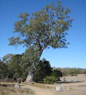
About 15 km further north along the Chetwynd Rd is a signposted turnoff on the left to Bilstons Tree which is considered to have the largest volume of millable river red gum in the world. It is thought to be 800 years old and stands over 40m high with a girth of seven metres, consisting of 9100 cubic feet of timber. In recent years a large limb has fallen and a local artist has carved over 16 native animals into the fallen limb, this is a must see if you’re in the area.
-
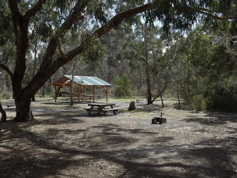
The Carmichael Track
The Carmichael Track is signposted off the Casterton-Penola Rd (the Glenelg Highway), west of Casterton. The main picnic area (which has barbecue and toilet facilities) is readily accessible by car but a 4WD is required to venture further at certain times of the year. The walking track leads through an abundance of wildflowers in season, though it is pleasant at any time of the year.
-
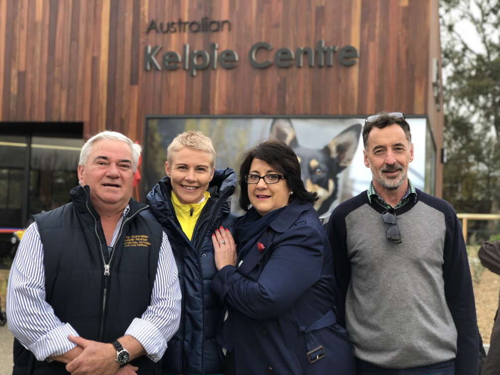
Australian Kelpie Centre
 Telephone: 03 5554 2440
After more than a decade campaigning, the hard work and determination of the Casterton community has come to fruition with the official opening of the Australian Kelpie Centre on Saturday 9th June 2018.
The $1.5 million building was officially opened at the 2018 Australian Kelpie Muster by Member for Wannon, Mr. Dan Tehan, who secured more than $650,000 of federal funding to realise the project.
The Henty street facility, situated in the heart of the Kelpie Trail, includes a Visitor Information Centre, meeting spaces, amenities and an interpretive display showcasing the history of the Kelpie Working Dog. The centre is believed to be the world’s only dog museum.
The story of Casterton and its rich cultural heritage will now be showcased for generations to come thanks to the highly successful branding efforts of the local community, an... -
A Kelpie Walking Trail
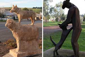
Meandering gently around town, the Kelpie Walking Trail links 5 unique sculptures revealing the fascinating life and times of the Kelpie.
The statues feature interpretive signage and the walker can chose from three routes.
Route 1 will take you via the main shopping district with its heritage-themed streetscape, while Route 2 is slightly longer and takes in some wonderful River Red-Gums and riverbank.
Route 3 comprises the River Walking Trail, along the beautiful banks of the Glenelg River.
Download the Walking Trail map -
Longlead Swamp Track
Longlead Swamp Track is further west (about 11 km from Casterton) along the highway (signposted to the right). It is another bush track with wildflowers and barbecue facilities. There are waterbirds, kangaroos and emus.
-
Red-tailed Black Cockatoo project
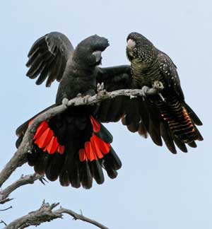
In danger of extinction, the sub-species South Eastern Red-tailed Black-Cockatoo (Calyptorhynchus banksii graptogyne) is only found in South-West Victoria and South East S.A.
These magnificent birds feed on the seeds of Brown Stringybarks and Bulokes -
Railway Reserve
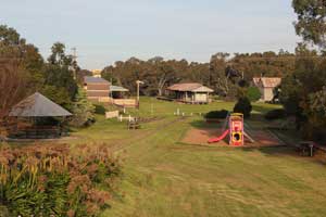
The Railway Reserve features a railway-themed playground and shady rotunda. This reserve is home of the historically registered railway station constructed in 1884 and known as the ‘Casterton Prototype’ of all stations built in Victoria in this era.
-
Ess Lagoon
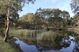
The picturesque Ess Lagoon offers a Free (RV Only) Camping area, tranquil picnic areas and fishing spots, that are regularly stocked with trout (A comprehensive Fishing Guide available at Casterton Visitor Information Centre, located at the Australian Kelpie Centre.
-
The Dergholm State Park and Baileys Rocks
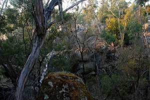
Baileys Rocks are a series of enormous and unusual green-coloured granite boulders in a dry creek bed within the northern section of Dergholm State Park. At Baileys Rocks Picnic and Camping Area there are toilets, fuel barbecues, picnic tables, drinking water and two walking tracks. A short (3230-metre) loop track leads to the boulders while the Rocky Creek Trail (5 km return) starts further upstream. It is clearly marked by blue arrows and is about 5 km return.
The park covers 10 400 ha and is divided into two blocks which are separated by the Dergholm-Edenhope Rd. Once occupied by the Kanalgundidj clan (part of the Jardwadjali language group), it was declared a Park in 1992. Ring (03) 5581 2427 for further details. -
The Glenelg River
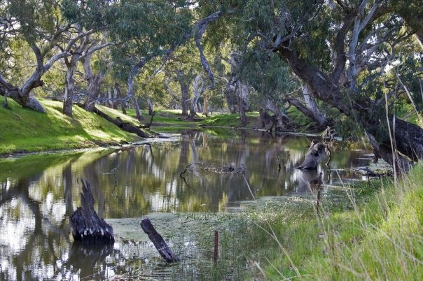
The Glenelg River is a link between many different types of environment. It starts in the mountainous Grampians and ends at the sea near Nelson. It goes through rich Red Gum country and the poorer sandy soils that are home to the Red-tailed Black-Cockatoo. For many creatures it is a corridor that allows free travel to different areas. The total length of the Glenelg River is over 350 kilometres. It has a length of approximately 85 kilometres through this sub-catchment, and passes through the township of Casterton.
-
Park and recreation areas in and around Casterton

Apex Park, is a popular BBQ stop. Both Bryan Park near the hospital and the Rotary Park, near the Jack Gleeson statue on the riverbank have fun playgrounds for the kids.
Island Park Recreation Reserve offers a full range of sporting facilities including a Caravan Park, BBQ, playground, Olympic swimming pool, bowling club, croquet lawn, tennis courts and sports ovals. Casterton also has an 18-hole golf course, racecourse and indoor sporting facilities.