The Glenelg Hopkins Catchment Management Authority
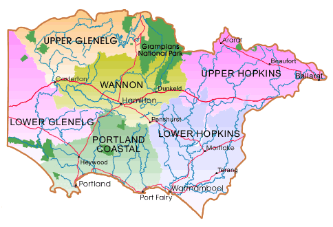
THE GLENELG HOPKINS CATCHMENT ENCOMPASSES THE GLENELG, HOPKINS AND PORTLAND COAST BASINS LYING SOUTH OF THE GREAT DIVIDING RANGE IN SOUTH WESTERN VICTORIA.
The region 25,000 square kms includes the cities and townships of Ballarat, Hamilton, Warrnambool, Ararat, Casterton, Mortlake, Port Fairy, Beaufort and Portland.
Major employment sources of agriculture, forestry and fishing provide nearly 25% of total employment. Agriculture is dominant, with forestry and fishing largely confined to the South -west coastal parts of the region.
Approximately 81% of the Glenelg Hopkins region has been developed for agricultural use. Around 2% of the catchment comprises pine forest, 16% is native forest and less than 1% is used for urban and industrial development.
The greatest impact on the region is the degradation caused by pest plant and animals, habitat loss, dryland salinity, decline in water quality of waterways and water erosion. These are many of the issues the Glenelg Hopkins CMA is trying to combat through its many programs. But it can only be done with the support of the community.www.ghcma.vic.gov.au